 FREE SHIPPING ON ORDERS OVER $30
FREE SHIPPING ON ORDERS OVER $30
 Sale!
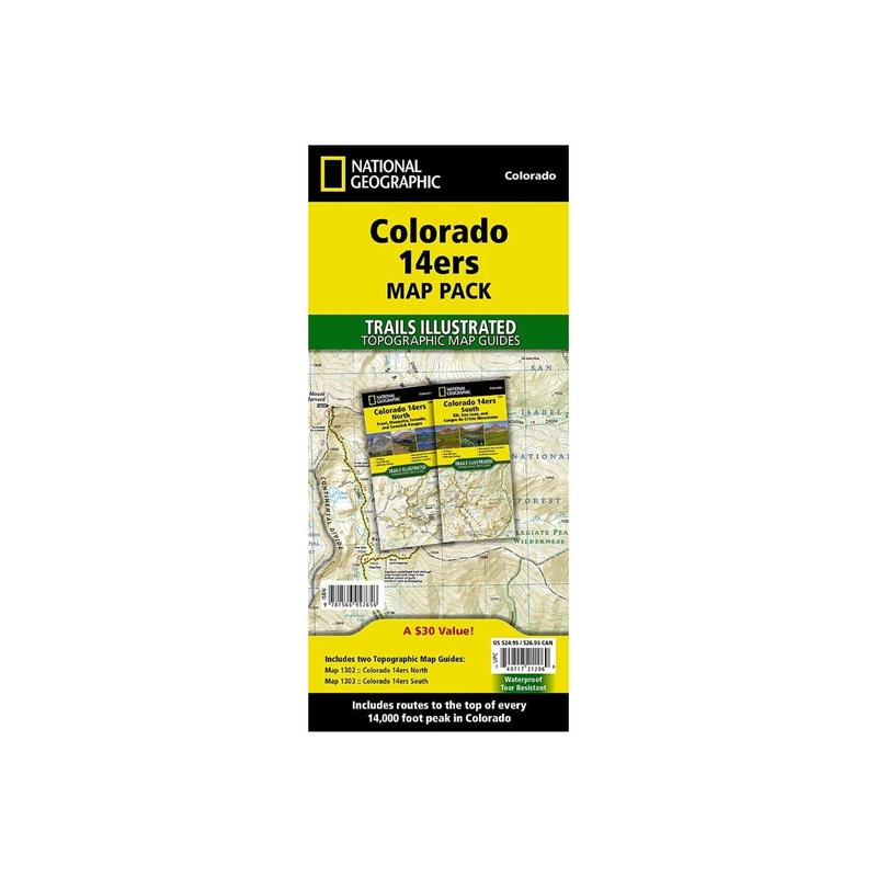
Sale! Colorado has the highest mean elevation of any state in the United States. It's home to 58 mountain peaks higher than 14,000 feetmore than any other state in the U.Smaking it a mountain sports mecca. "Bagging" these fourteeners is a goal for many Coloradan
Colorado has the highest mean elevation of any state in the United States. It’s home to 58 mountain peaks higher than 14,000 feetmore than any other state in the U.Smaking it a mountain sports mecca. “Bagging” these fourteeners is a goal for many Coloradans and visitors to the stateand for some, it’s an obsession.
Each map page provides accurate trail statistics including trail mileages, total elevation gain and loss, trailhead elevations and elevations at trail junctions, and directions to trailheads. Route information includes climbing class (i.e. difficulty rating) and points of reference along the route. The maps include both 2WD and 4WD trailhead locations for the standard, recommended route.
TheMap Packincludes every 14,000 peak in Colorado in a single, easy to purchase bundle.
The Colorado 14ers Map Pack includes:
More convenient and easier to use than folded maps, but just as compact and lightweight, National Geographic’sTopographic Map Guidebooklets are printed on ‘Backcountry Tough’ waterproof, tear-resistant paper with stainless steel staples. A full UTM grid is printed on the map to aid with GPS navigation.
Standard Shipping
Cost: $25
Free Shipping
We offer free shipping on orders over $30. Please check the free - shipping eligibility at checkout.
Delivery Time:
It usually takes [3-5] business days for standard shipping. Please note that this is an estimated time frame and may be affected by local holidays, and unforeseen circumstances.
Reviews
There are no reviews yet.