 FREE SHIPPING ON ORDERS OVER $30
FREE SHIPPING ON ORDERS OVER $30
 Sale!
Sale! Waterproof Tear-Resistant Topographic MapNational Geographic's Trails Illustrated map of Allegheny North delivers unmatched detail and valuable information to assist you in your exploration of this scenic national forest. Year-round recreation activities a
Waterproof Tear-Resistant Topographic Map
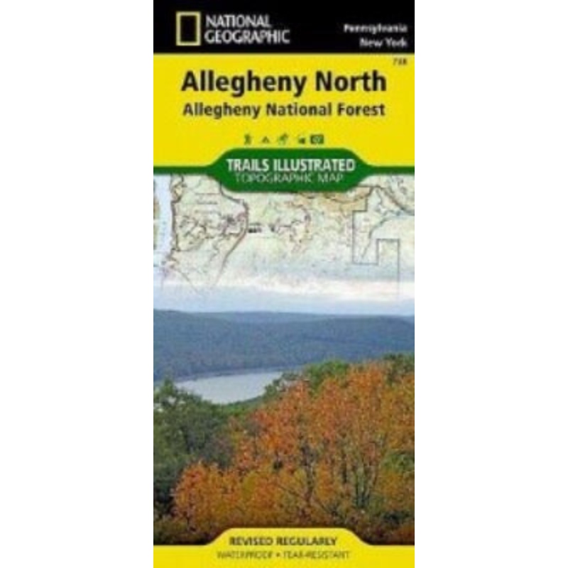
National Geographic’s Trails Illustrated map of Allegheny North delivers unmatched detail and valuable information to assist you in your exploration of this scenic national forest. Year-round recreation activities abound in the Allegheny National Recreation Area, Hickory Creek Wilderness, Chapman State Park, Allegheny Islands Wilderness, Kinzua Creek, and Tionesta and Hearts Content scenic areas. Created in partnership with local land management agencies, this expertly researched map delivers unmatched detail and helpful information for experienced outdoor enthusiasts and casual visitors alike.
This map can guide you off the beaten path and back again with miles of mapped trails including a portion of the popular North Country Trail, the Pennsylvania Highway Bike Route, the Allegheny Snowmobile Loop, and groomed cross country ski trails. Trail use is easy to identify, whether you’re traveling on foot or by bike, horse, or motorized vehicle. Trail mileage between intersections will assist you in choosing the path that’s right for you. River mileage is shown on a popular portion of the Allegheny River. The Longhouse Scenic Byway is noted for those wishing to take in the scenery by car. Many recreation features are noted as well, including campgrounds, boat launches, swimming areas, fishing access, interpretive trails, and points of interest. The map base includes contour lines, shaded relief, and elevations for summits, passes and many lakes.
Every Trails Illustrated map is printed on “Backcountry Tough” waterproof, tear-resistant paper. A full UTM grid is printed on the map to aid with GPS navigation.
Other features found on this map include: Allegheny National Forest, Brokenstraw Creek, Conewango Creek, Hickory Creek Wilderness.
Standard Shipping
Cost: $25
Free Shipping
We offer free shipping on orders over $30. Please check the free - shipping eligibility at checkout.
Delivery Time:
It usually takes [3-5] business days for standard shipping. Please note that this is an estimated time frame and may be affected by local holidays, and unforeseen circumstances.

Reviews
There are no reviews yet.